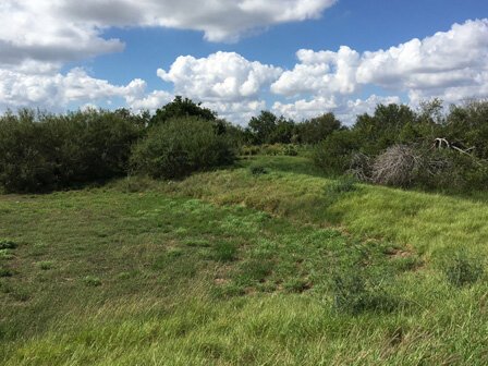
Fort Brown Earthworks
The original Fort Brown Earthworks, completed in 1846, are the remains of the only such fort in the United States built for the U.S.-Mexican War. Fort Brown was later expanded nearby and subsequently played a role in the Civil War, as a training ground during the Spanish-American War and as a point of mobilization during the Mexican Revolution. Collectively, Fort Brown’s significance to our nation’s military history and to the history of our state was recognized by its designation as a National Historic Landmark on December 19, 1960.
Over the last 170 years, the site has been impacted by time, with portions of the earthworks being removed prior to 1950. However, important parts of the fort survive, as well as significant archaeological remains below ground. Together, the battlefield sites of Fort Brown, Resaca de la Palma and Palo Alto tell the story of the internationally-strategic importance of the southern boundary of Texas and the Rio Grande delta.
Greater public awareness of their importance can have a positive impact on the understanding of the bilateral history of Mexico and the United States while supporting the heritage tourism economy of Brownsville and the Lower Rio Grande Valley.
Local and regional organizations and local and federal elected officials have expressed strong support for the long-term preservation of Fort Brown Earthworks. As the site is already owned by the International Boundary and Water Commission, the potential interagency transfer of management of the site to the National Park Service would be feasible and ensure appropriate stewardship and interpretation of Fort Brown.
For more information about Fort Brown, visit Fort Brown: In-Depth by CyArk.
LOCATION: Brownsville (Cameron County)
DESIGNATION: NHL, NRHP,
CONDITION: Fair
OWNER: International Boundary and Water Commission
RESOURCE TYPE: Fort
YEAR LISTED: 2017

